Archive
Archive for the ‘GIS’ Category
Mapping of Language Student Locations using PowerView
2014/03/09
Leave a comment
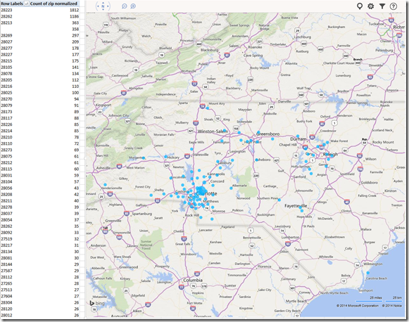
- What do our language students call home? Based on a pivot-table that counts zip codes, let PowerView tell you, which is can now distributed as a free add-in for Excel 2013 Prof, but you need to enable it (under File / Options / Add-Ins).

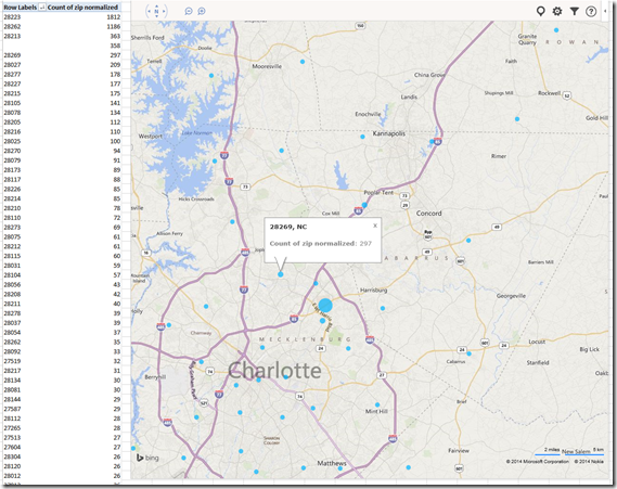
- Comes with a nifty zoom:


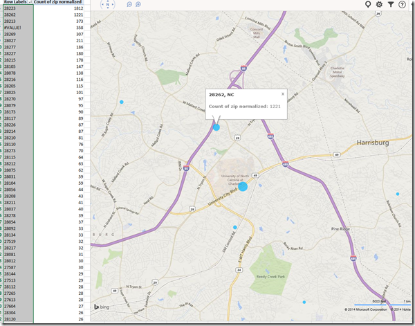
- Click, then Hover a data bubble for more info;

- Like with Bing Maps Visualization, the weighting is surprising:

Mapping of Language Student Locations using Bing Maps
2014/03/09
Leave a comment
- What do our language students call home? Based on a pivot-table that counts zip codes, let Bing Maps tell you, a default add-in easily accessible in the insert section of the ribbon:

- Note a Limitation: Bing Maps max 100 data points.

- So we limited to zip codes with at least 15 students (which returns just below 100 zip codes).
- Also note, the Bing maps app cannot be increased beyond a certain size (below is the maximum).

- Finally, note that the visualization does have a weight indicator, but it seems imperfect:


- Here is how data (type) input errors get handled (duplicates override the original):

- Fix your data, the reload from the upper right unfoldable menu:


- Voilà:

Easy adding and viewing GeoTags with your phone camera
2011/10/27
Leave a comment
- “Open your camera app, go to “Settings” (sprocket), menu item: “Geotagging”, “On”:

- Turning the phone’s the GPS on is not absolutely necessary, as this indoor basement shot proves:

- but will likely increase the accuracy of the Geotag in your photo greatly:

- How to view depends on your photo viewer application, above examples are taken from the free Windows Live Photo Gallery.
Categories: assignments, audience-is-students, digital-humanities, GIS, phones
camera, geotags, google-android, gps, windows-live-photo-gallery
Using geolocation information in photos for documentation?
2011/10/26
Leave a comment
- During documentation writing today, I noticed that my WlGallery suddenly (?) started displaying the geotags in pictures taken with my Palm Pixi which I set a long time ago to store (and share) location information. I t looks like this has started working earlier, but gone unnoticed.
 I also looks like it uses cell tower triangulation, not GPS data (when the latter is not available?):
  At such a granularity, this feature can not be useful for generating documentation. But maybe for excursions?
 - But seems still a bit iffy, on the Pixi side of things: I am pretty sure that previously, I could not see geotags in my photos, even though I tried several image metadata viewers. Also, the Pixi does not always add geotags: is this limited to pictures taken when there are network connectivity issues?
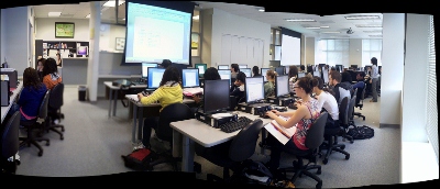
- Also seems like editing operations in wlgallery, including create panorama, “eat” the geotags in the output image….
Categories: e-infrastructure, GIS, mobile-phones, Notes, service-is-documenting
geotagging, gps, photos, pixi

